UAV-based mapping with imaging and LiDAR systems: challenges, data processing, and applications
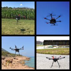
This workshop will seek contributions covering advanced topics related to the state of the art and future trends in 3D mapping using imaging and LiDAR units onboard Uncrewed Aerial Vehicles (UAVs). The growing interest in 3D mapping using sensing modalities onboard UAVs is motivated by continuous developments in direct geo-referencing technology (i.e., integrated Global Navigation Satellite Systems – GNSS – and Inertial Navigation Systems – INS) and remote sensing systems (i.e., passive and active imaging sensors in the visible and infrared range – RGB cameras, hyperspectral push-broom scanners, and laser scanning). Among others, solicited papers will cover the following topics: 1) algorithmic developments for improved system calibration of multi-sensor/multi-platform UAV-based mapping; 2) challenges facing UAV-based Structure-from-Motion strategies for deriving point clouds from imagery; 3) benefits of integrating imaging and LiDAR systems onboard UAVs; 4) applications of UAV-based remote sensing systems for a wide range of applications including precision agriculture, documentation of crash scenes, shoreline monitoring, digital forestry, and mapping of highway construction work zones; and 5) interactive visualization of multi-sensor/multi-platform/temporal geospatial data for improved comprehension of delivered products from UAV-based mobile mapping systems.
The workshop will be part of the ISPRS Geospatial Week 2023 hosted by the Arab Academy for Science, Technology, and Maritime Transport (AASTMT) in parallel with several related geospatial workshops.
Purdue University, USA
University of Calgary, Canada (WG I/7)
CHAIRS
Themes of event:
-
Multi-rotor, fixed-wing, and hybrid UAVs
-
System calibration
-
Georeferencing: direct, indirect, and integrated sensor orientation
-
Structure form motion
-
Data analytics for LiDAR point clouds
-
Visual and LiDAR SLAM
-
UAV mapping applications
-
UAV mapping in GNSS-challenging/denied environments
-
Sensor fusion in support of UAV navigation and mapping
-
Deep Learning strategies in support UAV mapping activities
-
Visualization of UAV data and products
-
Integration of UAV data with geospatial data from high-altitude and terrestrial platforms
-
Creating benchmark training datasets for deep learning strategies
-
Quality assurance and quality control of UAV mapping
Scientific Committee:
-
Mohamed Mostafa, Trimble
-
Adel Moussa, UofC
-
Kai-Wei Cheng, National Cheng Kung University, Taiwan
-
Andrea Masiero, University of Florence, Italy
-
Aboelmagd Noureldin, Queens University, Canada
-
Cheng Wang, Xiamen University, China
-
Antonio Vettore, University of Padova, Italy
-
Allison Kealy, RMIT, Australia
-
Mohamed Elhabiby, Micro Engineering Tech Inc. (METI), Canada
-
Jonathan Li, University of Waterloo, Canada
-
Chenglu Wen, Xiamen University, China


