Semantics3D – Semantic Scene Analysis and 3D Reconstruction from Images and Image Sequences
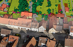
Automated 3D reconstruction and the extraction of semantic information from images and image sequences are important research topics in Photogrammetry, Remote Sensing, GIS, and Computer Vision. This workshop is a follow-up to the first event under the same name embedded in the ISPRS Geospatial Week 2019 in Enschede. It will bring together experts working in photogrammetric 3D reconstruction, semantic interpretation of imagery and image sequence analysis to discuss recent developments, the potential of various data sources, and future trends in 3D reconstruction and information extraction from imagery. Its focus is on methodological research. Semantic3D will be part of the ISPRS Geospatial Week 2023, hosted by the Arab Academy for Science, Technology, and Maritime Transport, in parallel with a number of related geospatial workshops. The event will be held as a two-day single track workshop of oral presentations and poster sessions in the context of the ISPRS Geospatial Week.
CHAIRS

Themes of event:
-
Feature extraction, stereo/multi-view sparse matching, dense image matching
-
3D data acquisition and surface reconstruction
-
Automatic detection and 3D reconstruction of objects using data from terrestrial, airborne or satellite sensors
-
Deep learning and other supervised methods for 3D reconstruction and for the semantic interpretation of 3D scenes based on images, point clouds, or surface meshes
-
Multi-source, multi-view, multi-temporal, multi-modal image analysis: Integration of data from multiple viewpoints or multiple sensors for automated object detection and 3D reconstruction
-
Integration of existing interpreted data such as historical maps or urban GIS for object detection and reconstruction
-
Uncertainty estimation and uncertainty propagation in 3D reconstruction and classification
-
Methods for the generation and update of high-resolution 3D city models and road databases
-
Object detection, recognition, 3D reconstruction and tracking in the context of robotics or autonomous driving and mobile mapping
-
Dynamic scene understanding
-
Change detection in image time series and 3D point clouds
-
Integration of images, motion and vehicle models
-
Video analysis for security/surveillance tasks
-
Explainable machine learning for geospatial applications
-
Methods to overcome data biases, limited labels, and weak labels
-
Evaluation of performance, speed, reliability, robustness, and generalization ability of methods
Scientific Committee:
-
Ksenia Bittner, German Aerospace Center(DLR), Germany
-
Jan Böhm, University College London, UK
-
Max Coenen, Leibniz Universität Hannover, Germany
-
Pablo d’Angelo, German Aerospace Center (DLR), Germany
-
Friedrich Fraundorfer, Graz University of Technology, Austria
-
Markus Gerke, Technische Universität Braunschweig, Germany
-
Norbert Haala, University of Stuttgart, Germany
-
Dorota Iwanszczuk, TU Darmstadt, Germany
-
Jinha Jung, Purdue University, USA
-
Arpan Kusari, University of Michigan, USA
-
Florent Lafarge, INRIA, Sophia Antipolis, France
-
Loic Landrieu, National Geographical Institute, France
-
Max Mehltretter, Leibniz Universität Hannover, Germany
-
Sander Oude Elberink, University of Twente, The Netherlands
-
Charlotte Pelletier, University of Southern Brittany, France
-
Ribana Roscher, University of Bonn, Germany
-
Franz Rottensteiner, Leibniz Universität Hannover, Germany
-
Marc Russwurm, Federal Institute of Technology (EPFL), Lausanne, Switzerland
-
Maria Vakalopoulou, University of Paris-Saclay, France
-
Bruno Vallet, Institut Géographique National (IGN), France
-
Jan Dirk Wegner, University of Zurich, Switzerland
-
Martin Weinmann, Karlsruhe Institute of Technology, Germany
-
Wen Xiao, China University of Geosciences, China
-
Bisheng Yang, Wuhan University, China
-
Michael Ying Yang, University of Twente, The Netherlands
Others tba.
Supporting ISPRS Working Groups:
-
WG II/2 Point cloud acquisition and processing
-
WG II/3 3D scene reconstruction for modeling & mapping
-
WG II/4 AI / ML for geospatial data
-
WG II/5 Temporal geospatial data understanding


