Instructor
Ayman F. Habib
Thomas A. Page Professor in Civil Engineering
Lyles School of Civil Engineering, Purdue University, USA
UAV-based 3D mapping using imaging and LiDAR systems: challenges, data processing, and applications
Tutorial Scope
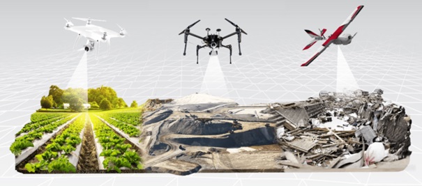
The continuous developments in direct geo-referencing technology (i.e., integrated Global Navigation Satellite Systems – GNSS – and Inertial Navigation Systems – INS) and remote sensing systems (i.e., passive and active imaging sensors in the visible and infrared range – RGB cameras, hyperspectral push-broom scanners, and laser scanning) are providing the professional geospatial community with ever-growing opportunities to generate accurate 3D information with rich set of attributes. These advances are also coupled with improvement in the sensors’ performance, reduction in the associated cost, and miniaturization of such sensors. Aside from the sensing systems, we are also enjoying the emerging of promising platforms such as Uncrewed Aerial Vehicles (UAVs). This tutorial will provide an overview of recent activities focusing on UAV-based mapping while highlighting: 1) algorithmic developments for improved system calibration of multi-sensor/multi-platform UAV-based mapping; 2) challenges facing UAV-based Structure-from-Motion strategies for deriving point clouds from imagery; 3) benefits of integrating imaging and LiDAR systems onboard UAVs; 4) applications of UAV-based remote sensing systems for a wide range of applications including precision agriculture, documentation of crash scenes, shoreline monitoring, digital forestry, and mapping of highway construction work zones; and 5) interactive visualization of multi-sensor/multi-platform/temporal geospatial data for improved comprehension of delivered products from UAV-based mobile mapping systems.
Instractor BIO
Dr. Habib is the Thomas A. Page professor of Civil Engineering at Purdue University and the Co-Director of the Civil Engineering Center for Applications of UAS for a Sustainable Environment (CE-CAUSE). He is also the Associate Director of Purdue University’s Joint Transportation Research Program (JTRP). Dr. Habib’s research interests span the fields of terrestrial and aerial mobile mapping systems. He has been focusing on modeling the perspective geometry of non-traditional imaging scanners, automatic matching and change detection, automatic calibration of low-cost digital cameras, object recognition in imagery and point cloud data, LiDAR mapping, and integrating photogrammetric data with other sensors/datasets (e.g., GNSS/INS, GIS databases, multi- and hyper-spectral sensors, and LiDAR). Over the last seven years, he has been involved in the development, integration, and utilization of wheel-based and UAV-based mobile mapping systems for a wide range of applications in precision agriculture, geometric documentation of transportation corridors, digital forestry, crash scene reconstruction, cultural heritage documentation, environmental management, and infrastructure monitoring.


