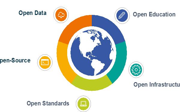
Openness in Geospatial and Remote Sensing
Openness helps improve access, use, reuse, and delivery of trustworthy information and data, foster innovation, shape new policies and enrich the delivery of services for societal needs in a more open and transparent manner. In the Geospatial and Remote Sensing domains, the concept of Openness is at the core of several initiatives, from policies and legal interventions in the field of Spatial Data Infrastructures (SDIs) such as e.g., the European INSPIRE Directive, to publicly-funded programmes like Copernicus, international partnerships such as the Group on Earth Observation (GEO), research approaches fostering open science, and community-led projects such as Pangeo, OpenStreetMap and the UN OpenGIS Initiative. The concept of Openness is based on three main elements: Accessibility (of data, software, standards and information), Inclusiveness (growing participation of diverse communities and partnerships between different actors: public sector, private sector, academia and citizens), and Reproducibility (effective sharing and reuse of resources and collaboration through open software tools, frameworks, libraries and open infrastructures).
This workshop aims at bringing together experts in Open Source for Geospatial and Open Earth Observation Science and Applications to: i) discuss the advancements in the fields of open source software, open standards, open science, open innovation and open educational resources in the Geospatial and Remote Sensing domains; ii) explore new technology developments that enable Openness in Geospatial and Remote Sensing; iii) evaluate how Openness contributes to scientific advancements; and iv) showcase applications that build upon open principles to deliver products and information with societal benefits. We welcome all types of papers addressing the above, including research papers, review papers as well as papers presenting new technology, approaches and case studies and highlighting the originality compared to the state of the art. We especially welcome papers that – to the maximum extent possible – are reproducible, i.e. make all artefacts (input data, computational steps, methods and code) openly available so that consistent results can be achieved. When available, the code used in the research work shall be released under an open source license.
The workshop will be part of the ISPRS Geospatial Week 2023, and is organised by the ISPRS ICWG IV/III/II Openness in Geospatial Science and Remote Sensing. It will be a one-day single-track workshop of oral presentations and poster sessions.
CHAIRS
Themes of event:
- Advancements in and applications of Open Source Software for Geospatial
- Open and FAIR Data, Workflows and Knowledge – openness across the whole research lifecycle
- Open Infrastructures for Geospatial and Remote Sensing research
- Open Earth Observation Platforms and Open Earth/Geospatial Science in the cloud
- Use cases and applications based on Open Standards
- Transparency and reproducibility of solutions based on machine learning and deep learning
- Open Geospatial data, including from collaborative projects such as OpenStreetMap
- Open Geospatial communities and education – managing communities, new initiatives for open science, methods, and tools to promote openness
- Open Innovation and Participatory Research
Scientific Committee:
- Codrina Maria Ilie, University of Technical Engineering of Bucharest and Terrasigna, Romania
- Peter Mooney, Maynooth University, Ireland
- Yair Grinberger, The Hebrew University of Jerusalem, Israel
- Claudia Vitolo, European Space Agency, Italy
- Stefanie Lumnitz, European Space Agency, Italy
- Stephan Meissl, EOX IT Services, Austria
- Alessandro Sarretta, National Research Council, Italy
- Alexander Kotsev, European Commission – Joint Research Centre (JRC), Italy
- Albana Kona, European Commission – Joint Research Centre (JRC), Italy
- Daniele Oxoli, Politecnico di Milano, Italy
- Marian Neagul, West University of Timisoara, România
Other members to be added
Supporting ISPRS Working Groups:
- ICWG IV/III/V Openness in Geospatial Science and Remote Sensing


